Mapping the Organ Mountains Desert Peaks National Mounument
I researched and designed this set of maps in 2018 for a cartography course. My central idea here was to use design choices to complicate the abstraction of political boundaries.
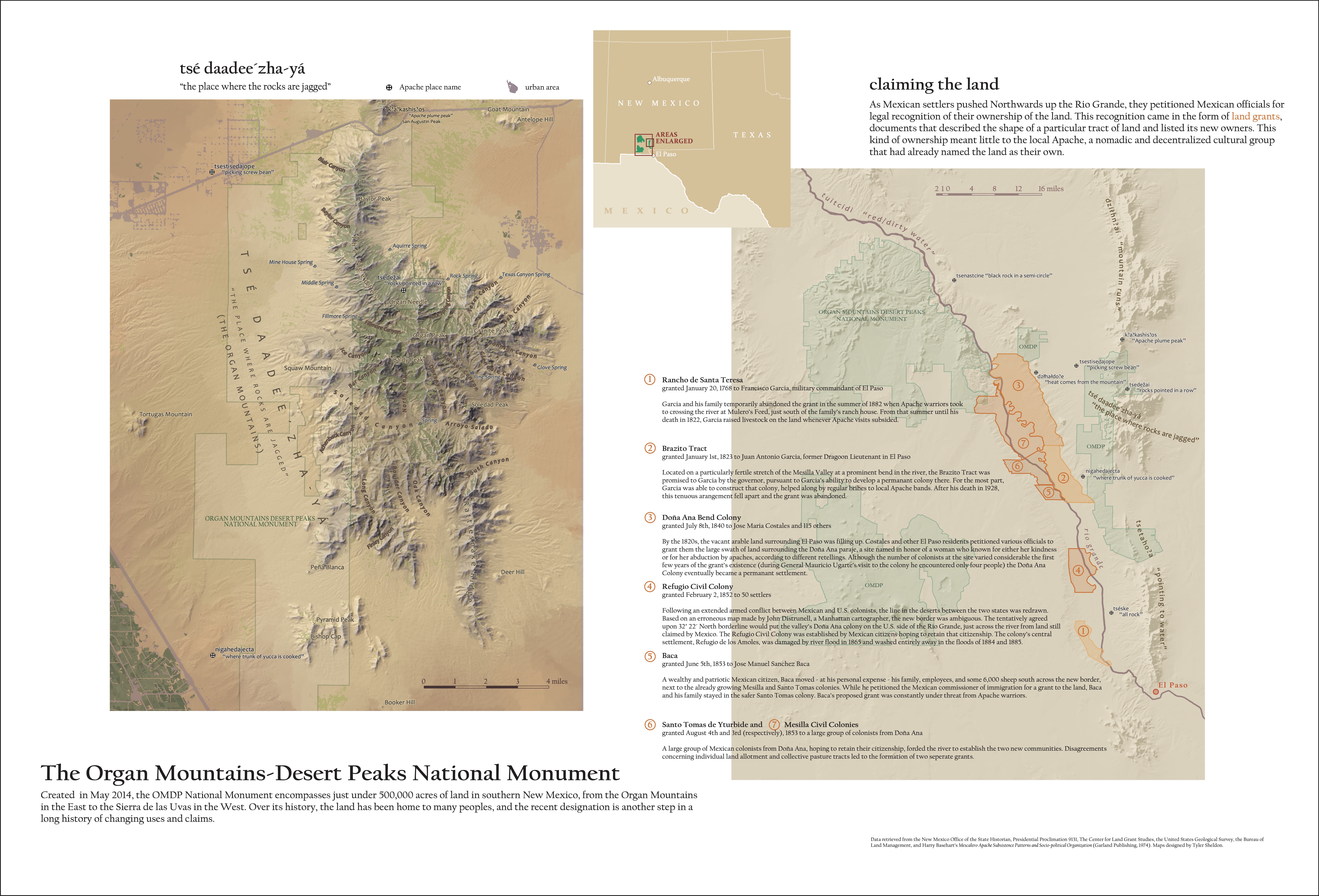
These maps focus on three different kinds of claim on the land: the U.S. Federal Government's National Monument designation, Mexican citizens' 18th and 19th-century land grants, and Apache place names. Ownership is an extaordinarily malleable idea, and Apache ownership in particular pushes the boundaries of the traditional political map. In centering Apache political power on place-names rather than demarcating its edges, I hoped to reflect Apache concepts of land ownership. Polygons can only take us so far.
The design was originally intended for a print medium, and online readers might need to squint a little to read the canyon names.
Thanks to Jeff Howarth for his excellent critiques.